Flood Modelling in Islington
Enquire Today For A Free No Obligation Quote
At Flood Modelling, we provide precision-engineered assessments that map and simulate how water interacts with land and infrastructure in Islington and across the UK.
We design our models to meet planning, compliance, and insurance requirements, utilising the latest hydrological data and software to predict potential flood events.
From small residential plots to major infrastructure projects, Flood Modelling reports give you the clarity needed to make safe, compliant, and cost-effective development decisions.
How Is Flood Modelling Used to Assess Risk in Islington?
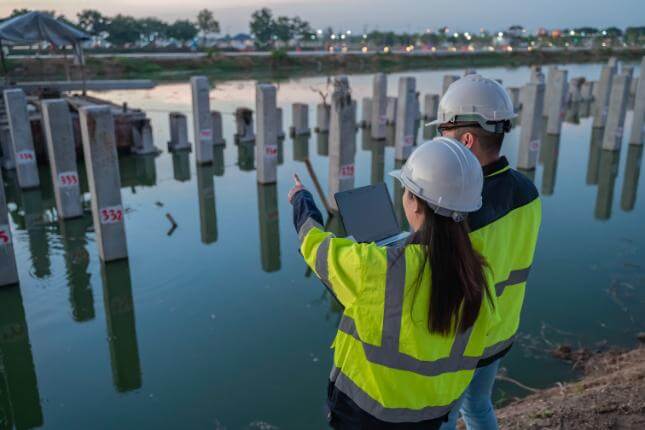
Flood modelling in Islington involves creating a computer-simulated representation of how water would behave on and around a specific site during different flood scenarios.
Developers, planners, and engineers use the results to identify high-risk areas, design effective mitigation measures, and meet Environment Agency and local authority requirements in Islington for flood safety.
Which Types of Developments Across Islington Require Detailed Flood Modelling Reports?
We provide flood modelling reports at Islington for a wide range of developments, particularly where planning approval requires evidence of flood risk management, including:
- Sites in Flood Zones 2 or 3 – Areas at medium or high risk of flooding from rivers or the sea.
- Developments near rivers, coastlines, or tidal areas – Locations vulnerable to fluvial or coastal flooding.
- Sites with poor surface water drainage – Properties where inadequate runoff management increases flood risk.
- Large housing schemes – Multi-plot residential developments that could alter drainage patterns.
- Commercial and mixed-use premises – Retail parks, business centres, and leisure facilities.
- Transport infrastructure – Roads, railways, and associated structures in flood-prone areas.
- Industrial facilities – Factories, warehouses, and distribution centres requiring robust flood mitigation.
- Sites outside high-risk zones with major drainage changes – Even low-risk locations may require modelling if development significantly impacts water flow.
How Much Does Professional Flood Modelling Cost in or Around Islington?
The cost of professional flood modelling in Islington ranges from £1,000 to over £10,000, depending on the site size, the complexity of local hydrology, and the level of detail required in the modelling report.
Costs are primarily influenced by factors such as the number of flood scenarios tested, the need for advanced hydraulic simulations, the availability of accurate survey data, and any additional assessments required by planning authorities.
Contact Flood Modelling in Greater London to get a customised price for your development or property.
How Do Flood Risk Consultants in Islington Use Modelling to Support Planning Applications?
Flood risk consultants in Islington use modelling results to demonstrate to planning authorities that a development will manage water safely and sustainably.
The model outputs help justify site layouts, drainage strategies, and mitigation features such as raised floor levels or flood storage areas. They also provide evidence for sequential and exception tests, showing that flood risk in Islington has been considered and appropriately addressed.
What Data Is Collected for Accurate Flood Models in the Islington Area?
To create accurate flood models in Islington, we collect and analyse a range of site-specific and regional data, including:
- Topographical surveys – Detailed measurements of land height and surface features.
- LiDAR elevation mapping – High-resolution terrain data to capture subtle changes in ground levels.
- Historical flood records – Past flood event data to identify patterns and recurrence.
- Rainfall intensity statistics – Localised rainfall rates used to model storm events.
- River flow measurements – Flow rates and volumes for nearby rivers and streams.
- Ground permeability tests – Assessments of soil infiltration capacity.
- Drainage system condition and capacity – Evaluations of existing surface water and foul water infrastructure.
- Environment Agency datasets – Official hydrological and flood risk mapping for wider catchment modelling.
Can Flood Modelling in Islington Predict the Impact of Future Climate Scenarios?
Modern flood modelling in Islington incorporates climate change allowances recommended by the Environment Agency, projecting how flood risks could evolve over the next 50 to 100 years.
This forward-looking approach is vital for ensuring developments in Islington remain safe and functional as weather patterns become more extreme and sea levels rise.
Do Flood Models in Islington Comply With Environment Agency and Local Authority Requirements?
All flood models we produce in Islington are developed to meet the specific submission criteria of the Environment Agency and the relevant local planning authority.
We liaise directly with these bodies where necessary to ensure the modelling approach is approved before work begins, reducing the risk of delaysin Islington during the planning process.
What Software and Methodologies Are Used for Flood Modelling Across Islington?
Our flood modelling process in Islington uses advanced software and proven methodologies to ensure accuracy and compliance, including:
- TUFLOW – Industry-standard hydraulic modelling software for simulating flood behaviour in complex environments.
- Flood Modeller Pro – Professional tool for river, coastal, and surface water flood analysis.
- HEC-RAS – Widely used for river hydraulics, floodplain mapping, and water flow simulation.
- 1D hydraulic simulations – Model water movement along river channels and drainage networks.
- 2D hydraulic simulations – Assess flood spread, depth, and velocity across wider areas.
- CIRIA guidance – Following recognised best practices for flood risk management.
- DEFRA standards – Ensuring compliance with government-approved methodologies.
- Environment Agency requirements – Aligning outputs with local authority and regulatory submission criteria.
How Long Does It Take to Complete a Flood Modelling Assessment in or Around Islington?
Turnaround times for flood modelling in Islington typically range from two to six weeks, depending on site size, data availability, and the number of modelling scenarios required.
We can expedite urgent projects where planning deadlines are approaching, provided sufficient survey data is available at the outset.
Contact Flood Modelling in Islington for a consultation on getting flood modelling from our experts.
Find More Info
Make sure you contact us today for a number of great flood modelling services in Islington.
For more information on flood modelling in Islington N1 2, fill in the contact form below to receive a free quote today.
★★★★★
“We commissioned Flood Modelling to assess flood risk for a major infrastructure project in West Yorkshire. Their comprehensive report, using the latest software and data, allowed us to design effective mitigation measures and satisfy all regulatory requirements. I highly recommend their expertise to anyone needing reliable flood risk analysis.”
Tobias Hargreaves
Greater London
★★★★★
“Flood Modelling provided an exceptionally detailed simulation for our coastal development in Dorset. Their advanced hydraulic models gave us precise insights into potential flood risks, which was invaluable for our planning application. The team’s professionalism and clear communication made the whole process straightforward.”
Rosalind Merton
Greater London